Stage 14 OS Map of PCP Stage 15 Stage 16
Stage 15 NEWGALE to DRUIDSTON HAVEN (21st May 2015)
We caught the #411 bus from St. David’s to Newgale Beach. There’s a shop, a pub and public toilets there.
Going South from the bus stop the Coast path follows the main road, almost immediately crossing the Brandy Brook on a footbridge. This stream forms the Landsker boundary line between Welsh speaking (to the North) and English (to the South). The language divide still has some significance and recent studies show there are DNA differences which persist between the two communities.
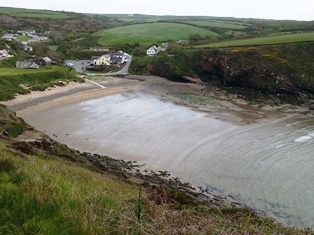
Newgale beach has a shingle bank piled high next to the road, above a 3km long sandy beach, not visible around high tide. The Coast Path follows the main road for around 500m before bearing right on a minor road, still parallel to the sea.
After almost 1 km the path leaves this road, to the right, following the cliff edge. The first signs of ancient mine workings appear. The cliffs south of Newgale have been eroded to reveal coal-bearing carboniferous strata and this has been mined since the 15th century. Over the years deeper pits were dug to exploit the minerals.
Trefrane Cliff colliery was situated nearby, the largest in the area, and a derelict chimney still remaining, just off the path, beyond Cliff Cottages. The mine shafts went out under the sea and were prone to sea incursions. Mining ended around the beginning of the 20th century in this area but there remain massive coal reserves here.
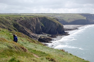
The path passes Black Cliff and the prominent Rickets Head, a rocky much eroded headland, barely connected to the remaining cliffs by a narrow and crumbling causeway. The clifftops were a riot of wildflowers, just as elsewhere on the path at this time of year. The allegedly rare spring squill was everywhere and also creamy white rock roses pock-marked the heather. Patches of yellow kidney vetch and several other blue and pink vetches were apparent. The weak morning sunshine picked out spiders webs stretched between heather plants, each with a small downward funnel in the centre, the fine net-like surface glittering with minute dew drops which covered them.
After several stiff climbs and descents on this section the path slopes gently into the head of a bay at Nolton Haven, small tourist village now but formerly an important port for coal shipment. Here, adjacent to the minor road is a pub, car park and public toilets.
From the minor road outside the pub the Coast Path heads uphill and takes the right hand fork when this road almost immediately divides. Just beyond a chapel the Coast Path is signed, going back to the right.
The path follows the cliff on the edge of the haven bay, then above another sandy beach with natural arches and many caves.
As the path turns inland a strange, low, ultra-modern building appears, its long glass wall partly buried at each end in earth banks. It has a green roof and an incongruous steel chimney sticking up. This is the Malator House, converted from a former army building and fitting the stringent requirements of the National Park, that it should not intrude on its surroundings.
The Coast Path descends to the beach at Druidston Haven, another wide sandy stretch on which riders exercise the horses from the nearby stables. Two small streams join here to enter the sea and the Coast Path goes inland, between these streams, heading up a narrow valley. The stepped section of path to the right is a path leading to Druidstones Hotel, on the clifftop.
Where the Coast Path meets a minor road turn right to follow the road uphill, passing another interesting eco-property, a small octagonal building with wind turbine and solar panels. This is a sustainably converted 19th century croquet pavilion, now a self-catering cottage for rent. Just beyond is the Druidstones hotel and restaurant, in large grounds.
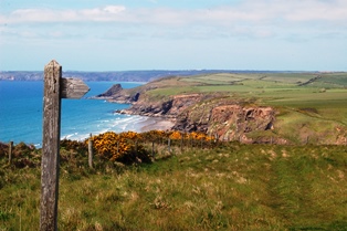
Continue up the road for another 200m and follow the Coast Path acorn sign to the right, following the road on the far side of a wall. At the top, at a field boundary the path goes right, away from the road, approaching the cliff edge at a view point, Druidston Chins. There are great views in all directions across St. Brides Bay, from Ramsey Island and Carn Penberry, beyond St. David’s to the North, out to Skomer Island in the South West. As we watched, a kestrel hovered above the cliff edge, occasionally swooping and returning.
We turned back along the path, to catch the Puffin Shuttle bus (#400) from near the Druidstones hotel, to St. David’s.
The Pembrokeshire Coastal Path is one of the official UK National Trails, running from Amroth to St. Dogmaels, along clifftops, beaches and estuaries. The total length is 300 kilometres (185 miles).
You can download this route to your GPS or mobile phone by clicking on the 'View route..' link on the map below (provided you have registered (free) with ViewRanger
Get Ordnance Survey maps on your website to enhance the service and customer experience.
photos by Michael Beer
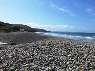 Shingle Bank on Newgale Beach
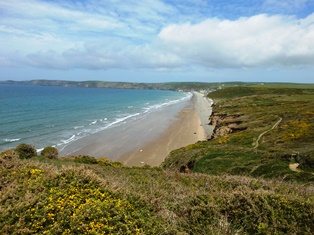 The length of Newgale Beach
 Surfers on Newgale Beach
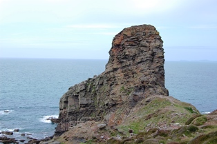 Rickets Head
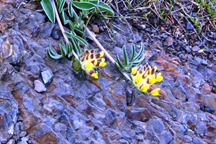 Kidney vetch
 Davey William Haven
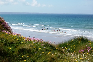
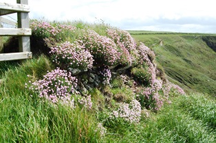 Banks of thrift
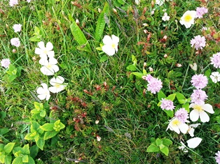 Wild flowers
 Nolton Haven
 View N from Druidston Chins