Stage 18 OS Map of PCP Stage 19 Stage 20
Stage 19 St. JUSTINIAN to WHITESAND BAY (19th May 2015)
The invaluable Celtic Coaster bus (#403) takes several routes in turn from its base in St. Davids to points on the coast. It took us to St. Justinians and we set off up the coast in another gale with spells of brilliant sunshine and clear blue sky.
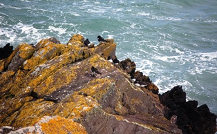
The path from the old lifeboat house squeezes between a small hut and a fence, then up a narrow track right on the cliff edge. The on-shore breeze blew spray up wide clefts in the cliffs, formed by the erosion of vertical slabs of strata. Thrift grew down the sides of the same clefts, somehow thriving in the onslaught of wind and sea. A lone gannet patrolled up and down the cliff edge at the entrance to Ramsey Sound.
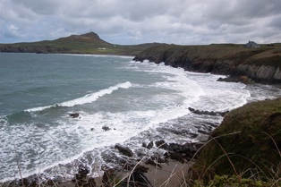
The path meanders around the headland to Point St. John then, just past a scatter of large offshore rocks, a sandy cove at Porthselau comes into view. The range of wild flowers in bloom at this time of late spring was really surprising; cowslips bloomed on the exposed clifftops, bluebells and violets in the hedgerows and even a sweep of primroses clinging to the Cliffside. This is without mentioning the masses of thrift, gorse and yellow heather flowering in profusion. We were attracted by the cry of an oyster catcher and looked down to see eight of them sheltering in a cluster in the lee of a small rock at the base of the cliff.
The sheltered path descends to cross a stream near the foot of the cliff, rising again to pass one or two houses.
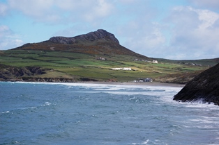
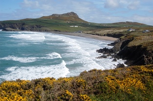
Then the much longer stretch of beach at Whitesands Bay is straight ahead. There are steps down onto the beach but the Path stays on the clifftop, only going down to sea level by the large Lifesavers Club building.
Beyond this, set back a little, is an eco-friendly modern café and shop with good snacks and information panels about the wildlife, geology and history of this unique environment. The sweeping beach is excellent for surfing with long straight rollers coming in from the open sea. Further out there are small islands in all directions. Far out to sea a white lighthouse stands out on one of the furthest islands (South Bishop) some 9km off shore. This is the southern most island of a line of rocky outcrops (the Bishop and Clerks) running North in St. George’s Channel, and always a danger to shipping.
There are public toilets in the car park and this is where the Celtic Cruiser picks up walkers for the return journey to St. Davids (half-hourly service in high summer).
The Pembrokeshire Coastal Path is one of the official UK National Trails, running from Amroth to St. Dogmaels, along clifftops, beaches and estuaries. The total length is 300 kilometres (185 miles).
You can download this route to your GPS or mobile phone by clicking on the 'View route..' link on the map below (provided you have registered (free) with ViewRanger
Get Ordnance Survey maps on your website to enhance the service and customer experience.
photos by Michael Beer
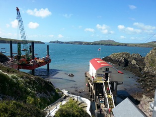 New and old lifeboat stations
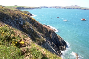 View of Ramsey Sound
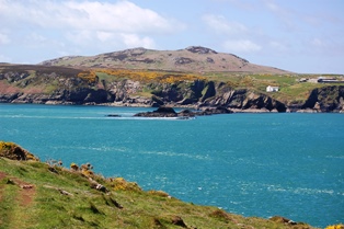 Ramsey Island
 Point St. John
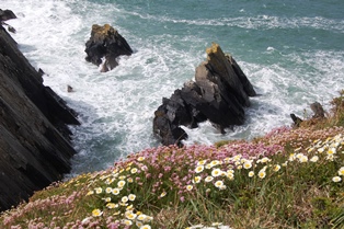
 Porthselau cove
 Eight oyster catchers
 The peak of Carn Llidi
 Whitesand Bay