SHIVERING MOUNTAIN CIRCUIT 10th May 2016
This circular walk takes in part of a long ridge path on the southern side of the Vale of Edale, including Mam Tor, also known as the Shivering Mountain for its tendency to disintegrate slowly in a series of landslips. The route starts with a climb up the closed end of the Vale, to Rushup Edge at the beginning of the ridge which runs for around 8km to Lose Hill. We leave the ridge at Hollins Cross, descending to the Vale at Edale village where there are pubs and a tea shop, before walking back along the leafy pastures beside the railway track to Barber Booth.
1. Leave Barber Booth village heading due S to immediately cross a bridge over the River Noe, an attractive small river which rises on the Kinder Scout plateau. In mid-May swathes of bluebells and wild garlic lined the banks, amongst trees just beginning to show the lightest green spring-time leaves.
2. Head straight up the minor road and where it veers left take a path right through a gateway onto a stony path heading diagonally uphill. There were newly returned lapwing wheeling and fluttering in the sheep pasture, making the classic pee-wit call.
3. As the path becomes steeper you pass through a five-bar gate to enter National Trust owned land. Here Chapel Gate track becomes steeper as it heads uphill but although stony the going is quite easy and the track broad. Climbing while gently bearing left, the track is joined by another coming in from the right, up from Dalehead, the NT Bunkhouse, in the secluded valley below.
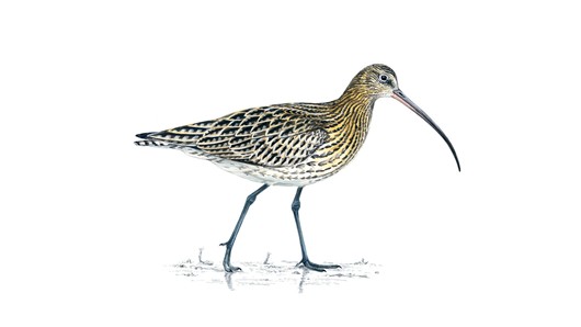
4. The walk up the hill was punctuated by plaintiff cries of curlews (I expect to hear them on seashores or estuaries not up mountains but they are apparently quite common here). Several skylarks were competing together to outsing the others. The path follows a beautifully constructed dry stone wall with another parallel one just beyond it, some sort of sheep-pen structure. The walls are made from the local sandstone (not the gritstone of the Dark Peak) which fractures into flat plates like slate but much thicker, ideal for a walls and roofs.
5. The path rises, passing some destroyed or excavated tumuli before reaching a much larger mound enclosed by a fence. This is Lord's Seat, a round barrow about which not much is known. Continue past it as the path follows the narrowing ridge, heading down towards a road crossing the ridge through a narrow slot in it, Mam's Nick. Beyond, Mam Tor rises conically with clear signs of the fortifications (banks and ditches) from when it was a late Bronze Age and Iron Age hillfort site. At the foot of the hills are a series of ridges remaining from major landslips in past times.
6. From the narrow ridge scramble down a steep and rocky path to the road, going left to a gate onto the road. Turn right and walk 100m to the entrance to the climb up to Mam Tor, paved with massive slabs with Iron Age symbols (torcs, pottery and round houses) set into them at intervals. The origin of the name is disputed, some say it comes from the (vaguely) breast shape of the hill but, more intriguingly, it is also believed to owe its maternal name to the fact that it is prone to dramatic landslips, which can produce offspring hills at its base. The landslips arise because the geology consists of sandstone layer on top of an unstable shale layer, prone to movement after heavy and prolonged rain. A major road between Sheffield and Chapel-en-le-Frith had to be abandoned in 1979 when the cost of stabilising it became too high.
7. Below to the S is the village of Castleton and some caves where the unusual semi-precious banded mineral Blue John is mined. After the trig point continue down the paved track, passing through an impressive bank and ditch and noting the land-slipped surface, especially off to the right. Continue to a point on the narrow ridge where a path coming up from Castleton, off to the S, crosses the ridge path. There is a small memorial stone here. This is Hollins Cross.
8. Turn sharp left and head down a steep footpath for walkers only. The path stays close to a dried up stream course.
9. Go through a gate with a row of deserted farm cottages to the right and continue down past a stone barn on the left to reach another bridge over the River Noe.
10. Cross over and continue beside another minor stream to reach a minor road.
11. Here you can cross to follow a path over a field then under the railway line to reach the heart of Edale village. For the train station, Penny Pot cafe, public toilets and the Ramblers Inn, turn left along the road for 400m before turning right into the car park next to the station. Further up this road, past the pub is the Moorland Centre with information of all kinds.
12. To return to Barber Booth, turn in to the station yard (on the S side), walk along through the car park following a signpost 'Barber Booth via field path. This crosses the railway line following it westwards across undulating fields with sheep grazing, through several footpath gates before reaching another track where you turn left to re-cross the railway. You are now back in Barber Booth.
Total distance walked 12.3km (7.6miles). Ascent 350m Time walking 3hours.Get Ordnance Survey maps on your website to enhance the service and customer experience.
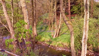 River Noe at Barber Booth
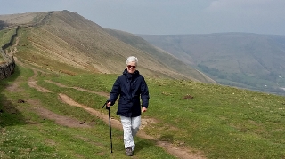 Rushup Edge and Dalehead
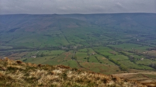 Vale of Edale
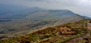 Mam Tor and ridge walk
 Vale of Edale in sun