COTSWOLD CANAL WALKS
Notes on the History and Renovation of the Cotswold Canals.
In the late 18th century two canals were built which led to a connection between two of England's most significant rivers, the Thames and the Severn. The area around Stroud, in the South Cotswolds, has a history stretching back to the Middle Ages as an important area for the production of woollen cloth. Transport to, through and from this area was difficult, due to the hilly terrain, punctuated by narrow steep sided river valleys. The Stroudwater (1779) and the Thames Severn Canals (1789) dramatically changed the situation, leading to a boom in the cloth making and processing business in the area of the five valleys, at the heart of which lies Stroud. Construction was relatively rapid, even by modern standards, and included digging what was then the longest tunnel in the world, the two-mile Sapperton Canal Tunnel. The ability to bring in coal easily via canal led to rapid industrialisation of the area and the canals allowed convenient transport to Bristol, via the Severn, and to London via the Thames.
The railway link between Gloucester and Swindon was built through the Frome valley in 1845. In many parts of the UK, trains rapidly killed off the canals but the Stroud waterways remained in service until the beginning of the twentieth century. In the subsequent decades they fell into disuse and a plan emerged in mid century to fill them in. However the Stroud valley communities, long renowned for protest and campaigning, gradually built up a head of steam to try to preserve and then to reopen these two waterways for full navigation. The very ambitious process is ongoing but by 2018 large stretches are fully restored. The towpath between Framilode and Sapperton is complete, although some canal stretches are reed covered and many locks are yet to be reopened. (The Sapperton tunnel remains closed though there are plans to reopen it in future).
Our Canal Walks
From a walker's viewpoint the canal provides excellent routes through the steeply wooded rural surroundings of the Frome valley, full of peaceful undisturbed nature but punctuated by small towns, dominated by their honey-coloured Cotswold-stone mills, and stuffed full of fascinating history, a good supply of pubs, cafes and other amenities, and a reasonable number of bus and train routes.
We began to walk along the canal in 2017, intending to link our Thames Path trek which finished at Thames Head, to our South West Coast Path at Minehead. This project is far from finished but the links below connect to the sections of the canal we have completed so far, with Ordnance Survey maps of the routes and full descriptions of where we went and what we saw.
Here are our Cotswold Canal walks:-
Use scroll and zoom buttons on map to move around.
Get Ordnance Survey maps on your website to enhance the service and customer experience.
Disclaimer: The author of these pages takes no responsibility for the accuracy of the directions given in the guided walks described here. Any walker following these directions does so entirely at their own risk.
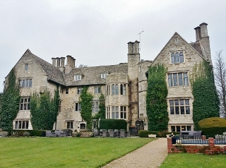 Stonehouse Court Hotel
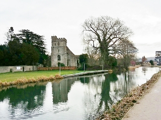 St. Cyr church
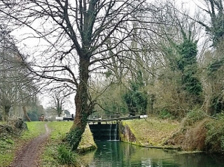 Blunder Lock
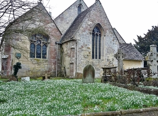 Eastington church
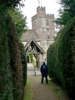 Yew hedges
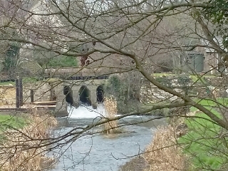 Canal meets River Frome
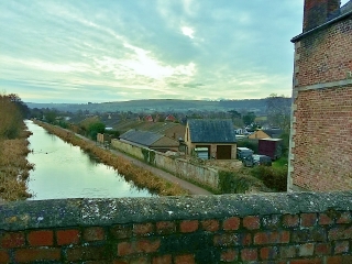 Nutshell Bridge